
The new dimensions of Dynamic Vegetation Management
The latest technologies can help you optimize your green spaces. Find out how we can help you with vegetation monitoring!
Reduce the cost of vegetation management with the HAWK System Platform
The reliability of overhead high- and medium-voltage lines and the preservation of environmental balance — which includes safeguarding protected tree species, nesting birds, public safety, and fire prevention — are closely tied to effective vegetation management. Uncontrolled vegetation growth near these lines can not only cause operational failures but also create ecological and safety challenges.
Fully automated technical solutions
Talamone Group offers a range of modern technologies in the field of vegetation management. We help you effectively manage your green spaces with satellite analysis, drone surveys, and camera solutions.


Satellite vegetation analysis: the key to future green space management
Satellite-based vegetation analysis enables accurate and efficient monitoring of green areas, providing real-time data on vegetation health.
Precision solution
Optimize vegetation management with the latest satellite technology.
Real-time data
Immediate information on the state of green spaces, helping you make quick decisions.
Drone technology for vegetation analysis: efficiency and precision all in one place
Drone-mounted sensors are revolutionising vegetation analysis, enabling detailed and accurate data collection. This technology allows us to survey green areas faster and more efficiently.
Innovative solution
Obtain on-demand insights about the vegetation, facilitating proactive decision-making and streamlined operations.
Cost-effective
Reduced labour requirements and faster results with drone solutions.

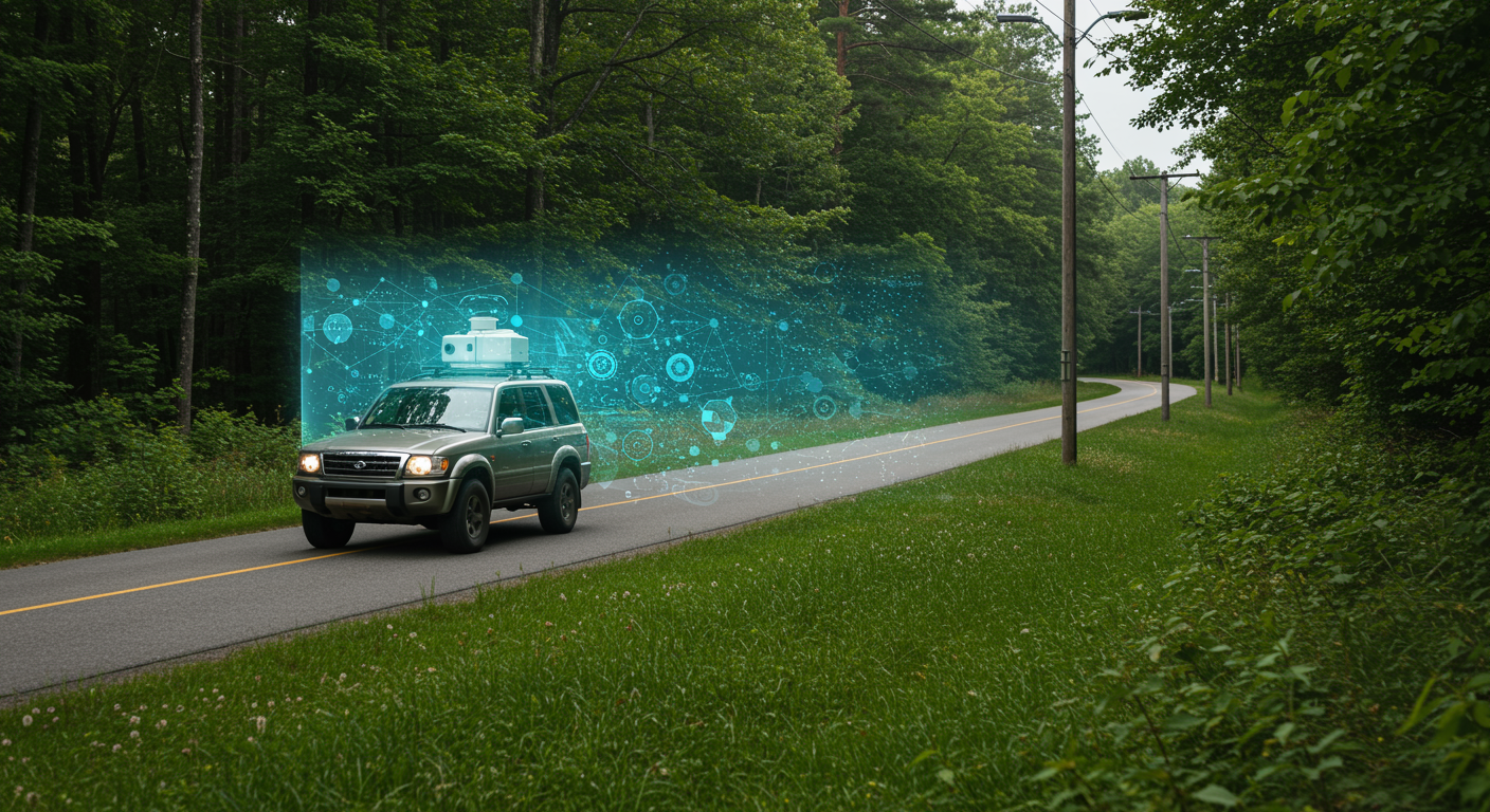
Precise vegetation analysis with our vehicles for efficient green space management
We use vehicle-mounted cameras to collect accurate and detailed vegetation data. This technology is suitable for analyzing vegetation in urban areas and alongside roadside electrical networks.
Innovative solutions
Real-time data for optimal management and maintenance of green spaces.
Efficient analysis
Easy-to-understand and fast information on the state of vegetation.
A significant proportion of the failures in the overhead power line network are related to vegetation along the lines. A large part of maintenance costs comes from clearing the lines’ safety zone and managing vegetation, so it is important to handle these tasks in a controlled and efficient manner, aligned with asset management objectives.
Data-driven Work Management
Planning phase
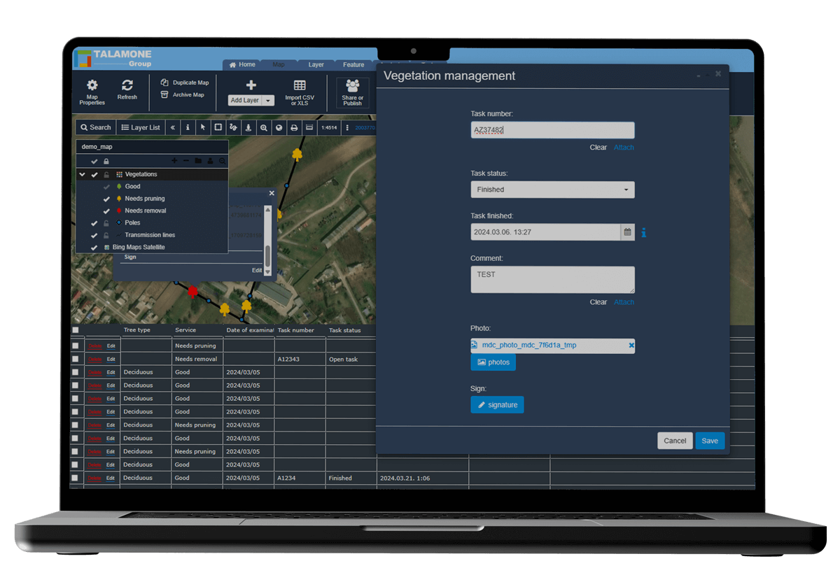
Work assignment, task completion report
Simple documentation form
On-site recording with targeted task sets
Accurate documentation with photo-based proof
Responsible work performance
A US study found that the dynamic approach reduced outages in stormy weather by 16-48%
Dynamic vegetation management plays a significant role in the operation of electricity distribution companies, particularly in reducing outages, increasing network reliability and minimising fire risk. The integration of modern technologies allows for proactive risk management and cost-effective resource allocation.

Risk identification and prioritization
Our dynamic vegetation management platform uses LiDAR, satellite imagery and artificial intelligence to identify hazardous vegetation close to power lines. This allows early detection of threats such as:

Increasing storm resistance and reliability
A dynamic approach is key to managing extreme weather events:

Regulatory compliance and cost reduction
The platforms integrate legal requirements into workflows: